During the last years the requirements for maritime administrators and terms of safety, the efficiency of operations and the environmental protection has increased significantly. In order to meet these increasing demands, the largest and busiest ports in the world use ESRI GIS technology – the world standard in the GIS field.
GIS solutions of ESRI allow to creating, collecting, processing, analyzing and visualizing various information for the port’s infrastructure, the vessels, the aquatory, etc. It allows bi-directional data exchange with the existing internal and external information systems, which contributes to better information insurance. The ESRI GIS solutions optimize the cost of the equipment and create preconditions for the implementation of international standards and regulations.

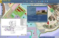
One of the busiest ports in the world - Port of Sines, Portugal, using Esri GIS for planning and managing their business. Developed GIS is a platform integrating all the systems of the harbor, including AIS, JUP, PPR, SAP, SSP, CUP, DW and ALOHA.