For the first time, the city’s planning information is made publicly accessible through a unified interactive platform that facilitates the viewing, processing, and analysis of data
Veliko Tarnovo now has a state-of-the-art platform for access to information from the Municipality’s General Development Plan (OУПО). The new system, developed by Esri Bulgaria on the ArcGIS platform, integrates diverse spatial data into a GIS application that can now be easily used by citizens, investors, planners, and experts from the municipality and other institutions.
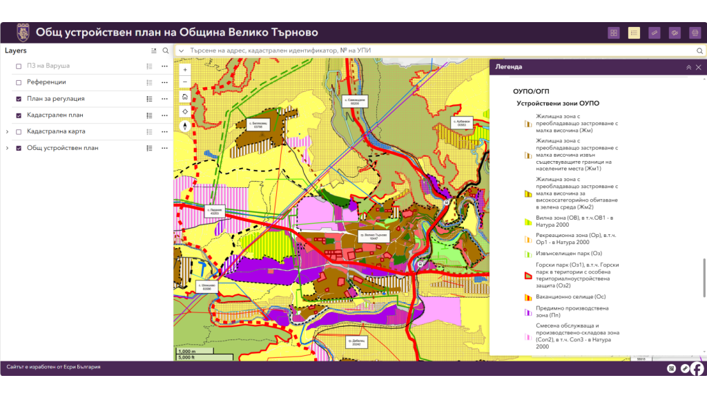
Interactive Platform with a Wide Range of Data
The developed system includes detailed data from the General Development Plan: regulatory plans, cadastral maps (both those used in the preparation of the plan and the current ones), cultural heritage sites, transport network, technical and utility infrastructure, natural and disturbed areas, protected areas under NATURA 2000, and more.
For the first time, so many different types of information have been integrated, providing a synergistic view and comparison of data – a key advantage in processes such as planning, investment interest, preparation of project documentation, or administrative inquiries.
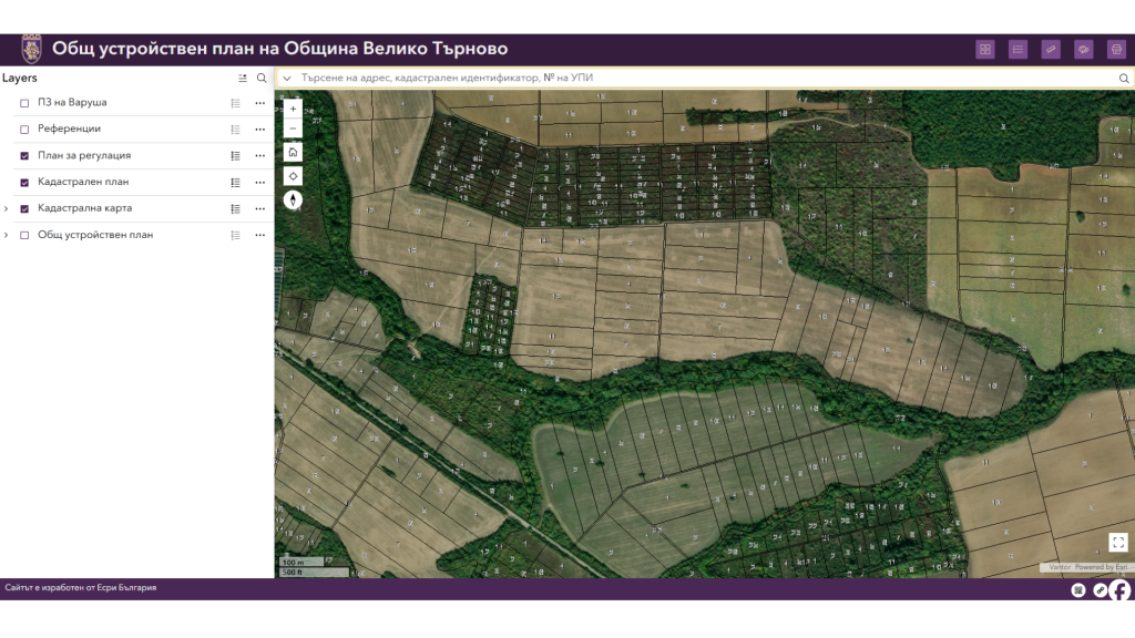
Useful Features for Users
The platform offers a set of tools that make working with planning information fast and intuitive. On the interactive map, users can check the characteristics of each object – planning zones, infrastructure elements, natural features, etc. Users can adjust layer transparency, change basemaps (including satellite imagery), measure distances and areas, and add notes to the map using various graphic tools. The platform is also accessible via mobile devices, allowing quick access to information and work with maps anywhere and at any time.
Particularly useful are the options for searching by address, cadastral identifier, or UPI number, as well as the option to view the location in Google Street Map directly by selecting it on the map. A map printing function is also available – a convenience when preparing documents and project materials.
Practical Benefits for Citizens, Businesses, and the Administration
The new system improves transparency and facilitates access to planning information. Citizens can quickly check important parameters of a property or an area they are interested in.
Investors have a reliable tool for the preliminary assessment of a given site and for planning future projects. Planners and architects gain access to up-to-date data needed for the preparation of planning and technical solutions.
For the administration, the platform means more efficient service, fewer routine inquiries, and clearer communication with the public. The system also includes functionalities for automating and optimizing the processes for preparing different types of sketches through the use of the ArcGIS Pro desktop GIS software. This accelerates data processing, ensures higher accuracy, and facilitates the experts’ daily work.
###