A Global Challenge with Local Dimensions
Climate change is already transforming the environment we live in. Droughts, wildfires, extreme temperatures, and floods are having tangible impacts on cities, infrastructure, agriculture, and public health.
Addressing these challenges requires insights and actions grounded in accurate data and location intelligence. Geographic Information Systems (GIS) provide exactly that: an integrated approach to monitoring, analysis, and decision-making based on real data about how climate processes unfold in specific places.
The Role of GIS in Climate Risk Assessment
GIS combines mapping, data processing, and visualization to make complex climate processes understandable. It helps institutions, businesses, and communities to:
• Identify risk areas, vulnerable populations, and critical infrastructure;
• Monitor changes over time using satellite and field data;
• Plan adaptation measures in response to a changing climate;
• Use up-to-date information for effective resource management and disaster response.
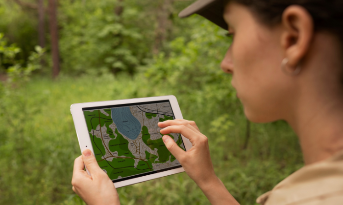
Maps That Drive Decisions: GIS in Action
Interactive maps created with GIS show not only what is happening, but also why. They visualize risks, highlight interdependencies, and support forecasting of the potential consequences of different actions. Here are some practical examples:
• Floods – GIS can model potential water spread during extreme rainfall in relation to roads, hospitals, and power networks, enabling targeted preparedness and evacuation planning.
• Droughts – Spatial data helps track affected areas and assess water source capacity to support sustainable water management.
• Wildfires – Historical and real-time data inform prevention strategies and rapid response plans to protect people and ecosystems.
• Extreme heat – GIS identifies urban heat islands and supports urban planning through the design of green spaces, shaded structures, and adaptive cooling measures.
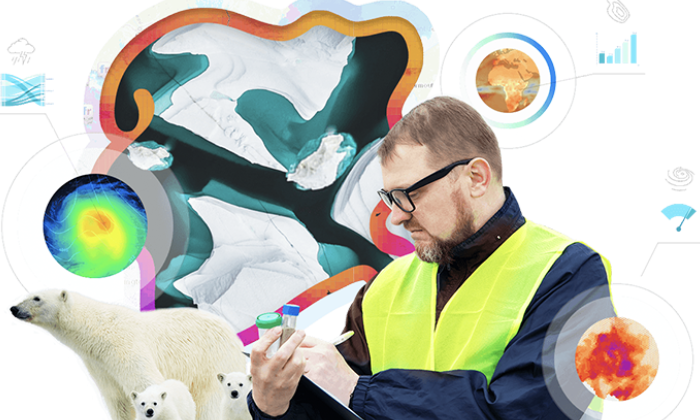
Modeling and Analysis for a Sustainable Future
GIS provides not only present-day data but also tools to explore possible futures, including:
• 3D modeling – Simulating climate events and assessing their impact on buildings, roads, and ecosystems;
• Artificial intelligence – Detecting patterns between climate data and socio-economic indicators to improve forecasting and prioritization;
• Scenario evaluation – Comparing different approaches to determine the most effective;
• Interactive dashboards – Consolidating real-time information on risks, resources, and response measures, accessible to all stakeholders.
Sector-Specific Applications of GIS
Energy, transport, and agriculture
• Optimizing locations for renewable energy installations (solar farms, wind parks);
• Analyzing transportation flows and supporting sustainable urban planning;
• Monitoring crop yields and adapting agricultural practices to new climate realities.
Cities and communities
• Analyzing urban heat islands – areas with excessive heat accumulation;
• Planning green and blue infrastructure – parks, water bodies, green roofs, rain gardens;
• Assessing vulnerable groups and developing local adaptation policies.
Education and awareness
• Using interactive web applications and educational maps to engage students, learners, and citizens;
• Visualizing climate trends in a clear and impactful way;
• Encouraging public participation in environmental initiatives.
GIS as a Framework for Resilience: Esri’s Solutions
Esri’s technology provides a comprehensive infrastructure for building resilient systems to address climate threats:
• Risk assessment – Integrating operational, environmental, and demographic data into unified maps;
• Identifying vulnerable assets – populations, critical infrastructure, ecosystems;
• Simulations and analysis – Using digital twins and 3D modeling;
• Real-time monitoring – Tracking climate events and resources as they happen;
• Interactive platforms – Enabling effective communication, data sharing, and coordination between institutions and communities.
Technology with a Vision for the Future
GIS does more than help us understand climate change — it turns information into something actionable, shareable, and practical.
By combining data, location, and analysis, GIS creates a new type of knowledge that leads to tangible action. In a world where every delay comes at a cost, GIS is the tool that helps us plan smarter, respond faster, and build a more resilient future.