How geospatial technologies ensure safety and sustainable modernization
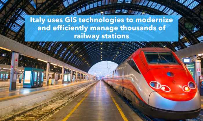
Italy is undertaking one of the largest infrastructure transformations in Europe, mapping and analyzing more than 18,000 kilometers of railway network and its surrounding environment using Geographic Information Systems (GIS).
At the core of this process is ArcGIS — a platform for spatial, 3D, and temporal analysis used to plan, design, and manage railway stations and infrastructure across the country.
Italy’s national railway infrastructure manager, Rete Ferroviaria Italiana (RFI), is significantly expanding its long-established GIS system with more than 400 new data layers. These layers cover not only railway infrastructure but also the surrounding context, including population, businesses, schools, hospitals, tourist sites, green spaces, transport connections, and human mobility patterns.
Each railway station is no longer viewed as an isolated building, but as an integral part of a dynamic urban system. Through spatial analysis, RFI gains a clear understanding of:
- how infrastructure affects safety, accessibility, and environmental quality;
- the risks to infrastructure, such as flooding and accidents;
- who lives and works in the areas surrounding railway stations;
- how people access stations — on foot, by bicycle, or via public transport;
- which services are lacking and what the real needs of local communities are;
- how pedestrians, vehicles, and shared mobility modes move through these areas.
This approach enables each railway station to receive a tailored solution aligned with its local context — from major cities to small towns.
From Maps to Multi-Billion-Euro Investments
RFI uses its GIS platform to ensure transparent management of more than 1,200 ongoing infrastructure projects, financed with part of the €25 billion allocated through the European Recovery and Resilience Facility. Spatial data and analysis form the backbone of strategic decision-making and the targeting of investments at both national and regional levels. Tangible outcomes include:
- the renovation of around 600 railway stations;
- the construction of new high-speed lines, including in Southern Italy;
- €41 million invested in pedestrian and cycling spaces around stations;
- an additional €150 million allocated to a network of cycle lanes connecting universities with railway stations.
GIS + BIM and Digital Twins
Italian Railways are implementing an integrated GIS and BIM (Building Information Modeling) approach, creating digital twins of railway stations — covering both outdoor environments and indoor spaces. This enables:
- enhanced security and safety;
- 3D analysis and testing of alternative solutions before real-world investment;
- improved planning of entrances, passenger flows, and functional zones;
- management of buildings, rooms, and technical systems;
- optimization of maintenance, cleaning, and operation across millions of square meters.
Italian Railways began the integrated use of GIS and BIM as early as 2018, initially to monitor construction progress on two key viaducts along the Naples–Bari railway line. The approach also incorporated the automated use of drone survey data within the GIS environment. The technology proved its effectiveness and was subsequently expanded to support planning and construction, cost assessment and tracking, evaluation of viaduct sustainability and service life, and comprehensive asset management.
Railway Stations as the New Centers of Urban Life
With the help of GIS data, underused spaces within railway stations are being transformed into places that deliver real value to people and local communities — cafés, retail outlets, and public services; coworking and social spaces; health centers and pharmacies in smaller towns; as well as cultural and environmental hubs.
The result is a new generation of railway stations — technologically advanced, environmentally sustainable, and designed around people’s needs, not just transportation. All of this is driven by GIS-based environmental and spatial analysis.
How GIS Supports Sustainable Infrastructure Planning
Italy’s example shows how GIS technologies go far beyond data visualization, becoming a strategic tool for national development, improved mobility, and a higher quality of life.
Today, one in four Italians lives or works within a 15-minute walk of a railway station — clear evidence that when infrastructure is planned with a deep understanding of space and people, the impact is both large-scale and long-lasting.
Integrated GIS approaches are also being applied in Bulgaria with the support of Esri Bulgaria, helping municipalities, public institutions, and businesses analyze territory and make informed, data-driven decisions based on spatial information.
###