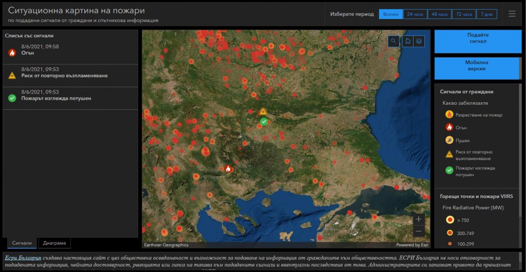
They are created in order to support communication in emergency situations in Bulgaria.
06 August 2021 – Esri Bulgaria has created a dashboard, with a Desktop and Mobile version, on which through interactive map Bulgarian citizens can find information about the current fires in the country. The dashboard is accompanied by an easy-to-fill online form, with which anyone who notices fire, smoke, etc. can give a signal by indicating the location and send a photo and description of the situation. In addition to the civil signals, the interactive map shows satellite information from NASA – VIIRS sensor for hot spots and fires not only in Bulgaria but all over the world, including the neighboring countries, where the fire situation is still very complicated.
The goal is through the capabilities of the latest GIS technologies to support communication and coordination in our society during emergencies.
“The resources of each country are limited even in times of emergency, the ability of the citizens to be “sensors” and to be able to easily and quickly submit information, as well as to be informed in a timely manner, is crucial,” said Ms. Evgenia Karadzhova, Esri Bulgaria CEO.

In such dynamic crises as summer fires, early localization of outbreaks is crucial. That is why Esri Bulgaria has developed the applications as part of its corporate social responsibility and provides them for free to society, incl. and the state administration. The company is not responsible for the submitted information, its reliability, reaction, or lack of reaction to the submitted signals and possible consequences thereof.