From transport and healthcare to a digital twin of Sofia’s Sredets District, the latest projects will be unveiled at the year’s leading GIS event

On 18 November, Bulgaria will mark the 27th World GIS Day with a major conference under the theme “GIS: The Power to Create an Intelligent Future Together.” The event will take place at Grand Hotel Millennium Sofia and is organised by Esri Bulgaria in partnership with more than 70 leading business, academic, non-governmental and media organisations. More than 900 Bulgarian and international experts are expected to attend.
Highlights of the programme will include the first demonstrations of the National Access Point for Transport Data, a GIS platform for analysing health inequalities in Bulgaria, and a digital twin of Sofia’s Sredets District.
Mark Gillik, Team Leader at the international humanitarian organisation MapAction, will be a special guest speaker at the event. He will demonstrate how modern GIS technologies support disaster and crisis response through rapid mapping, data analysis and the coordination of rescue operations. One example is the response to the floods in Mozambique in early 2026, when GIS analyses helped local authorities and the United Nations identify more than 600,000 people cut off by floodwaters and plan rescue routes and helicopter operations.
Brooks Patrick, Global Manager for Smart Cities and Regional Development at Esri, will also travel to Sofia especially for the event. He will present international projects and trends in geospatial technology, ranging from the use of GIS to attract investment to Italian cities and the development of the Rail Baltica railway corridor to GIS applications supporting the work of the Organization for Security and Co-operation in Europe (OSCE).
National Systems and Innovative GIS Applications in Bulgaria
The Ministry of Transport and Communications will showcase the new National Access Point for Transport Data (NAP) — part of the ministry’s GIS-based Unified Information Point platform. It brings together static and dynamic data on Bulgaria’s transport infrastructure and public transport, provides route-planning services and offers public interfaces for accessing the data.
Medical University of Varna will introduce participants to a GIS platform for assessing health inequalities in Bulgaria, developed as part of a research project funded by the Science Fund. The platform enables the mapping and analysis of population health status and the human, material and financial resources of the healthcare system. It also supports the assessment of risks and emergency response preparedness for natural and human-induced disasters at the subnational level.
For the first time on World GIS Day, the digital twin of Sofia’s Sredets District will also be demonstrated live. It combines a photorealistic 3D model of the area with urban planning analyses and real-time data.
The programme will also feature the interactive GIS system of the Black Sea Basin Directorate, designed to ensure oversight and transparency in the processing of public reports, as well as the Municipality of Targovishte’s system for spatial planning and industrial park asset management.
Visitors will have the opportunity to explore other GIS applications and completed projects in fields including the environment, spatial planning, local government, utilities, communications, security and education.
The technology session will showcase the latest developments in the ArcGIS platform, including AI agents and assistants, digital twins, infrastructure solutions, CAD and BIM integration, imagery analysis, real-time monitoring, security and mobile field applications.
Educational Projects and Annual Awards
World GIS Day will also spotlight young researchers and educational initiatives. On 18 November, a virtual exhibition featuring projects from the 2026 National Educational Competition “Exploring the World with GIS” will open. The competition is held under the patronage of the Ministry of Education and Science. The best interactive lessons and StoryMaps created by teachers, school students, university students and doctoral researchers will be recognised at an official awards ceremony. That evening, the winners of the second edition of the National Student Hackathon “GIS and Climate: Solutions for the Future” will also receive their awards.
The highlight of the major event will be the presentation of the annual GIS Special Achievement Awards, recognising organisations, teams and experts who have contributed to the development of geospatial technologies in Bulgaria.
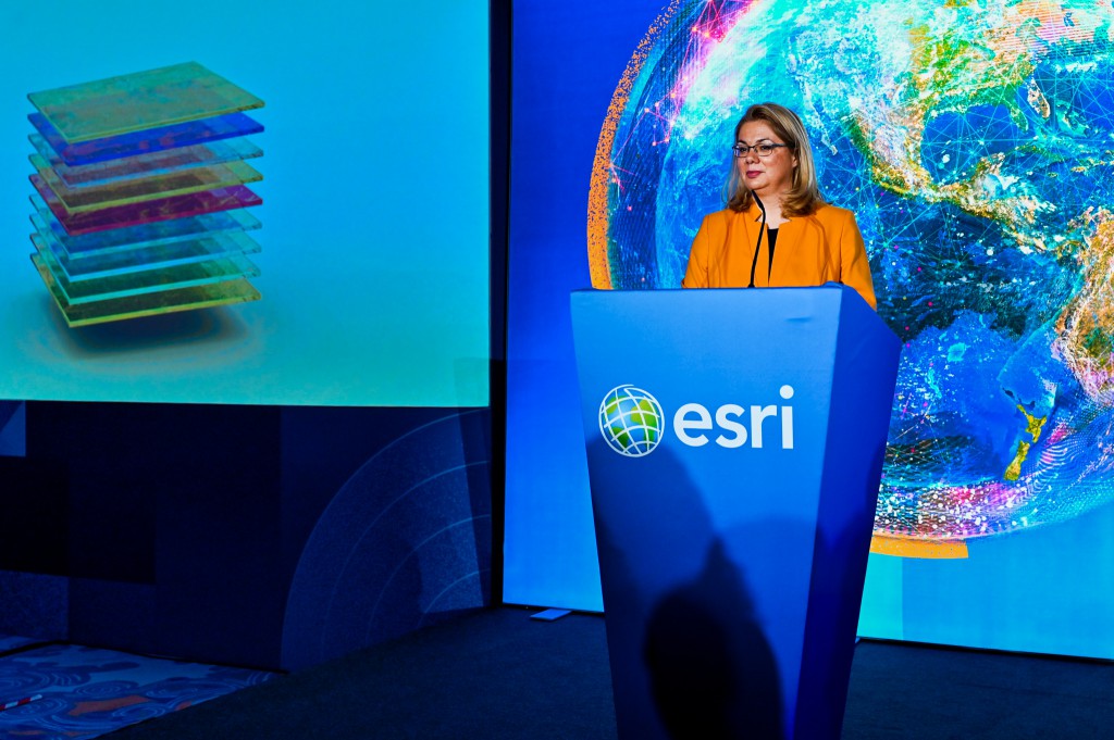
“GIS technologies are playing an increasingly important role in addressing societal and business challenges, from transport and healthcare to urban environment management and crisis response. World GIS Day provides an opportunity to showcase the tangible results of their application and demonstrate how collaboration among public institutions, businesses and the research community creates new opportunities for Bulgaria’s intelligent and sustainable development,” said Miglena Kuzmanova, Managing Director of Esri Bulgaria.
For more information about the programme and the event, visit: https://gisday.esribulgaria.com
World GIS Day is organised by Esri Bulgaria with the support of: Schneider Electric; PONTECH; HERE; Geographica; and Agora 66.
In partnership with:
Bulgarian Academy of Sciences; Faculty of Geology and Geography, Sofia University “St. Kliment Ohridski”; Faculty of Economics and Business Administration, Sofia University “St. Kliment Ohridski”; Faculty of Mathematics and Informatics, Sofia University “St. Kliment Ohridski”; University of Architecture, Civil Engineering and Geodesy; University of Mining and Geology “St. Ivan Rilski”; University of Forestry; Bulgarian Geographical Society; Bulgarian Cartographic Association; American Chamber of Commerce in Bulgaria; National Association of Municipalities in the Republic of Bulgaria; Foundation for Local Government Reform; Bulgarian Association of Information Technologies (BAIT); BASCOM; AFCEA Sofia Chapter; Atlantic Club of Bulgaria; Union of Surveyors and Land Managers in Bulgaria; Bulgarian Construction Chamber; Union of Architects in Bulgaria; Chamber of Architects in Bulgaria; Union of Urban Planners in Bulgaria; Bulgarian Water Association; Institute for Transport Infrastructure; Institute for Road Safety; Bulgarian Red Cross; Green Balkans; Bulgarian Mining and Geology Chamber; Bulgarian Natural Gas Association (BPGA); Association of Police Chiefs; Move.bg; Climateka; Digital National Coalition; Bulgarian Industrial Association; Bulgarian Chamber of Commerce and Industry; CMDR COE; Alliance of the Technology Industry (ATI); Association for Electronic Communications; Union of Landscape Architects; BAGIS; SCGIS Chapter Bulgaria (Society for the Conservation of Nature and Cultural Heritage with GIS – Bulgaria Chapter); Technical University of Sofia; New Bulgarian University; University of National and World Economy; Institute of Geospatial Research and Technology; University of Library Studies and Information Technologies (ULSIT); University of Telecommunications and Post; Angel Kanchev University of Ruse; Georgi S. Rakovski National Defence College; Academy of the Ministry of Interior; Defence Institute “Professor Tsvetan Lazarov”; Varna Free University “Chernorizets Hrabar”; Prof. Dr Asen Zlatarov University – Burgas; Vasil Levski National Military University; South-West University “Neofit Rilski”; Konstantin Preslavsky University of Shumen; Nikola Vaptsarov Naval Academy; St. Cyril and St. Methodius University of Veliko Tarnovo; D. A. Tsenov Academy of Economics; Space School; Hello, Space!; and the National High School of Mathematics and Science “Academician Lyubomir Chakalov” (NHSMG).
With media partnership from:
bTV Media Group; Dir.bg; Bulgarian National Radio; National Geographic Bulgaria; Darik National Radio; Utilities magazine; and Facilities magazine.
###