What will our city look like tomorrow or in 10 years?
With the growing needs of modern cities and the challenges related to sustainable development, the need for intelligent and integrated planning technologies has never been more pressing. This is where ArcGIS Urban comes in – a comprehensive web-based platform from Esri, designed specifically for urban planning, which transforms the way the future of the urban environment is structured, communicated, and analyzed. In this way, it facilitates communication with local communities, ensuring transparency and publicity of urban development processes.
ArcGIS Urban enables the creation of a living digital twin – a dynamic 3D model of the city that is updated with real data and reflects the current processes in the urbanized environment.
What is ArcGIS Urban?
ArcGIS Urban is a comprehensive platform for 3D modeling of the urban environment that supports strategic planning and more informed decision-making. The main directions of ArcGIS Urban include:
• 3D Modeling – Create and compare scenarios in a realistic urban environment;
• Real-time Data Analysis – Discover how different policies and investments affect the city – with ready-to-use templates and automatic calculation of key indicators;
• Digital Project Management – Track each project – from concept stage to approval – through a centralized system with integrated 3D models;
• Collaborative Planning – Share visions, collect online feedback, and engage citizens with comprehensible and impactful visualizations;
• Integrated Platform – Connect ArcGIS Urban with other systems, use APIs for automation, and immerse yourself in scenarios through XR technologies.
Through these functionalities, ArcGIS Urban not only supports professionals in planning but also facilitates citizen participation in the process by making information accessible and transparent.
What’s New in ArcGIS Urban
Project Editing
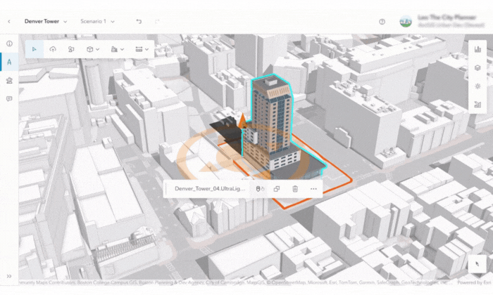
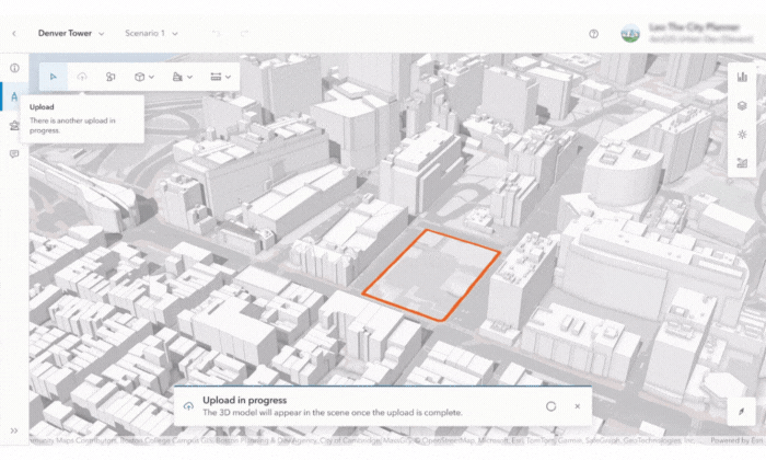
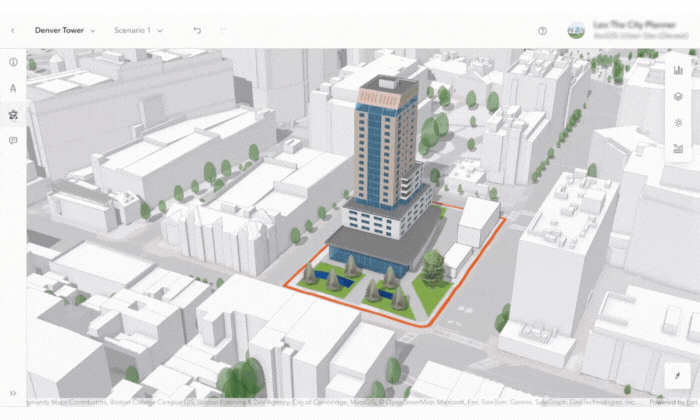
The project editor in ArcGIS Urban now offers a completely redesigned user experience with a focus on visualization and editing of detailed 3D models. 3D objects in formats such as IFC, DWG, and FBX can now be uploaded, stored as a 3D object layer for each individual scenario. Models can be positioned both manually and by coordinates.
The interface includes four main modes:
• Info – option to enter metadata, status, and extent;
• Development – creation and editing of 3D models;
• Analysis – performing analyses such as shadowing, visibility, and elevation profile;
• Discussion – opportunity for collaboration and adding comments.
Among the new features are improved tools for navigation and screenshots, as well as an updated top bar with quick access to scenarios, documentation, and project settings. In addition, nearby buildings from other projects are now automatically visualized in the editor.
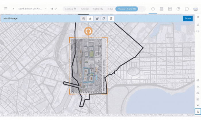
Plan Editing
The plan editor has also been updated with significant improvements. All projects within the plan’s scope are now visualized with their detailed 3D models. The new Image Upload function in the Details mode allows images to be uploaded to the plan. Uploaded images can be georeferenced using control points, copied between scenarios, and reordered by priority.
Dive into the Future with Urban XR
With Urban XR, you can not only see but also experience the future of the city. Through extended reality (XR) technologies, ArcGIS Urban enables interactive exploration of 3D scenes – directly from your browser. This new dimension in urban planning facilitates communication with stakeholders, makes projects understandable to the general public, and turns citizen participation into an engaging experience. No additional software is required – you immerse yourself directly in the environment and see what lies ahead. You can expect:
• Access to the entire city model;
• Comparison of different scenarios;
• Weather condition simulation;
• Choice of basemaps – with varying levels of detail;
• Dashboard – with object metrics;
• Visualization of the consequences of environmental changes;
• Transforming models into experiences for desktop or VR – without the need for programming skills;
• Real-time collaboration with stakeholders.
ArcGIS Urban is not just a tool – it is your partner in the process of creating smart, sustainable, and efficient cities. With its new functionalities and enhanced capabilities for 3D modeling, real-time analysis, and integration with technologies such as XR, the platform provides the resources needed to make informed decisions and achieve long-term goals. Take advantage of the opportunity to be part of the revolution in urban planning and to create cities adapted for future needs.
Author: Anzhela Petrova, GIS Consultant at Esri Bulgaria
###