 The first of its kind contest gathered in one interactive map more than 1,600 photos from participants from all over the country.
Sofia, 15 December 2020 – Over 1,600 photos of remarkable places from all over Bulgaria became part of the contest “Favourite places on the map of Bulgaria”, organized on the occasion of the 25th anniversary of Esri Bulgaria and in connection with the World Geographic Information Systems (GIS) Day. Within a month, amateur and professional photographers had the opportunity to use GIS technology and present their original shots of beautiful Bulgaria.
An interactive map of the most favorite and impressive places in Bulgaria was created with all the photos that meet the conditions for participation. The map, available at this link https://arcg.is/TOq4G0 , allows everyone to see virtually beautiful Bulgaria, photographed through the lenses of over 250 participants in the competition. It reflects beautiful natural and tourist attractions, as well as Bulgarian crafts from different parts of the country.

And here are the photos and their authors who took the leading places in the competition:
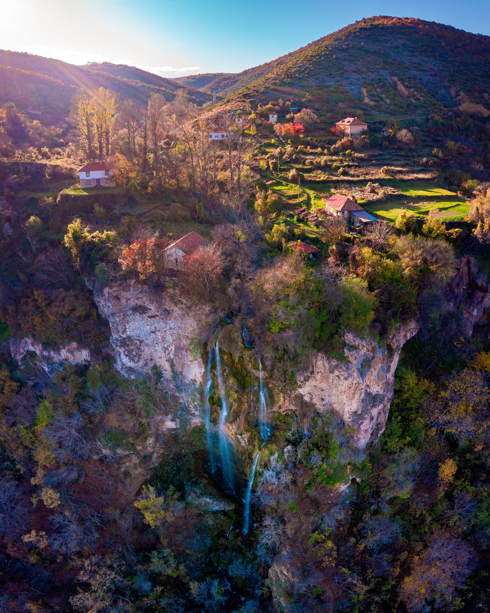
I-st place: Vladislav Chanev with the photo of Polsko-Skakavishki waterfall, Polska Skakavitsa village, Kyustendil Municipality
II-nd place: Elena Bozhkova, with the photo “Where time has stopped”, Sinemorets, Veleka beach seen from above

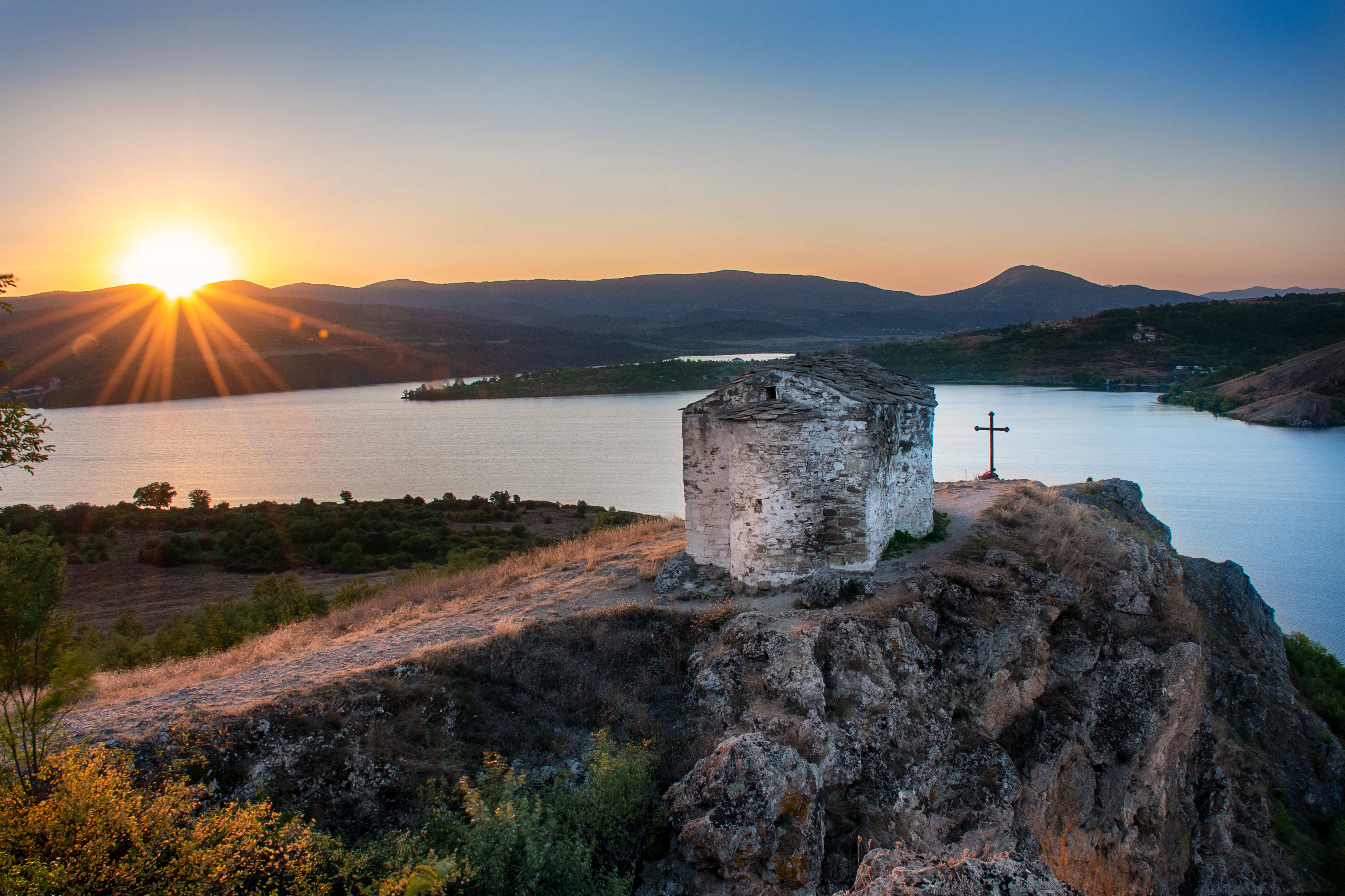
III place: Borislav Uzunov with the photo Chapel “St. Joan Letni ”, on one of the hills above Pchelina Dam.
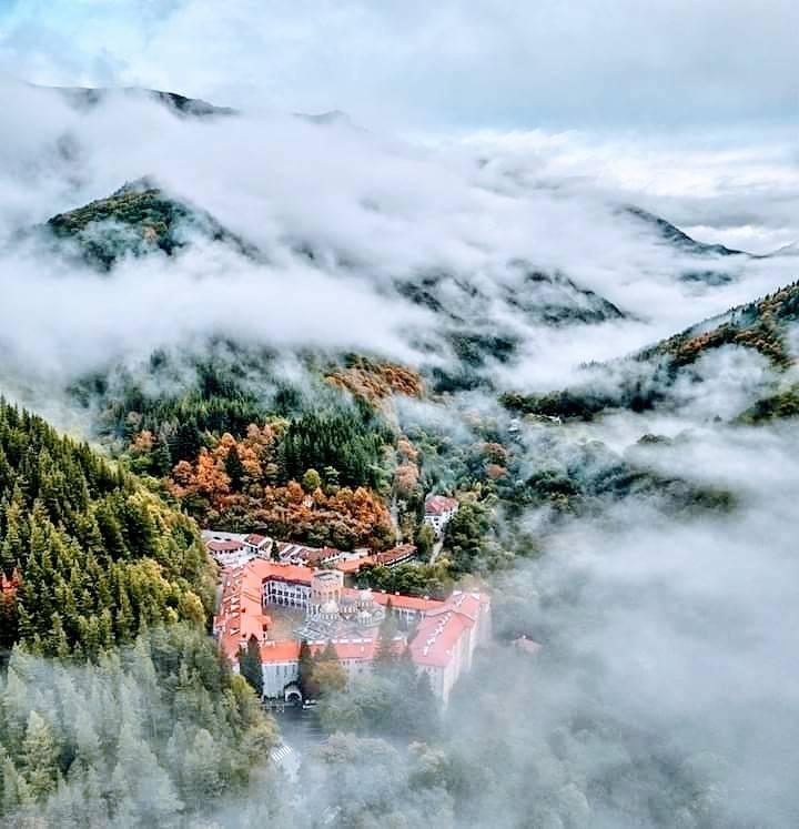
The organizers also presented two special awards. To Nesi Arnaud for the photo “God’s caress” of the monastery “St. Ivan Rilski ”
The other special award went to Georgi Raev for the photo“ Below the peak”on Malyovitsa peak in Rila.

The contest “Favourite places on the map of Bulgaria” is organized in partnership with National Geographic Bulgaria and PhotoPavilion. It is a continuation of the mission of Esri Bulgaria to develop and promote the use of geospatial technologies in various fields in our country. The competition is organized on the occasion of the World Geographic Information Systems Day on November 18, whose official organizer for the country is Esri Bulgaria, and which for more than 20 years is the main platform for sharing and exchanging experience, to present innovations in the field of geospatial technologies. The GIS technology that participants used to submit their photos in the contest is called Survey123, a simple and intuitive form-centric data gathering solution to easily create, share, and analyze surveys. The interactive GIS map that gathers all the photos of the participants is developed with the Esri cloud GIS platform ArcGIS Online.
###