Esri prepared a case study for the teaching with GIS process at the University of Mining and Geology.
Their story is based on conversations with professors and students who believe that GIS skills not only help them do more interesting projects but also provide a better professional perspective in the mining sector in our country. The University of Mining and Geology was established in 1953 and to date over 22,000 engineers have been trained in the fields of geology, mining, energy, and raw materials. Since almost all data in mining and geology has a spatial component, students study Geographic Information Systems (GIS) and in parallel gain hands-on experience using GIS technology.
GIS at the University of Mining and Geology
GIS has been studied at Moscow State University since the early 1990s, with professors gradually introducing software solutions from Esri’s ArcGIS platform. Since 2015, they have also been included in the Academic Esri Program for universities, under which they receive licenses for a number of software products, including ArcGIS Online, ArcGIS Web AppBuilder, Portal for ArcGIS, ArcGIS Collector, ArcGIS CityEngine, ArcGIS StoryMaps, etc.
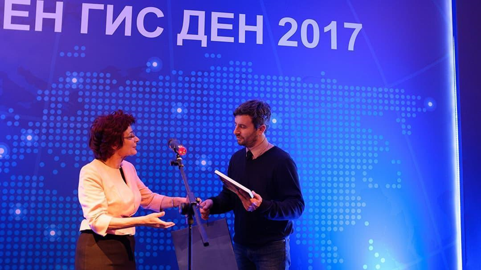
On behalf of UMG, Prof. Asparuh Kamburov accepts an award from Evgenia Karadjova, founder of Esri Bulgaria, during World GIS Day 2017.
Students gain experience from real projects
UMG students can work with various GIS tools. For example, they can survey their local environment and collect data using ArcGIS Collector, then use the 3D options in ArcScene to view the data. Experience with 3D tools proves to be particularly important for students in the Department of Mine Surveying and Geodesy.
Analysis of erosion in the Eastern Rhodopes
University of Mining and Geology` students and professors participate in various research projects to assess geological and geomorphological hazards. One such project uses 3D GIS tools to analyze erosion in the Eastern Rhodopes. Funded by the National Research Fund of the Ministry of Education and Science, the project aims to reveal the spatio-temporal dynamics of erosion and develop erosion susceptibility models in a GIS environment. Representatives of the “Geology and Geoinformatics” and “Surveying and Geodesy” departments work with researchers from the “Nikola Pushkarov” Institute of Soil Science, Agrotechnology and Plant Protection. In their latest collaboration, they obtained data from unmanned aerial vehicles (UAVs) and terrestrial laser scanning (TLS), which were processed and analyzed using ArcGIS Pro.
Protecting the environment and reducing the risks of natural disasters
Supported by the Ministry of Education and Science of Bulgaria is another UMG research project that uses GIS for the purpose of environmental protection and reducing the risks of natural disasters. Researchers use the tools in ArcGIS Pro to develop digital elevation models (DEMs) and derivative models of areas of interest. These models are used to determine changes in topographic surfaces due to landslides and other hazardous natural phenomena.
According to assistant Valentina Nikolova, working with GIS facilitates the understanding of the spatio-temporal features of the studied objects and phenomena. She adds that working with GIS tools and functionalities is very useful for students and that it contributes to strengthening and expanding the research capacity at the University of Mining and Geology.
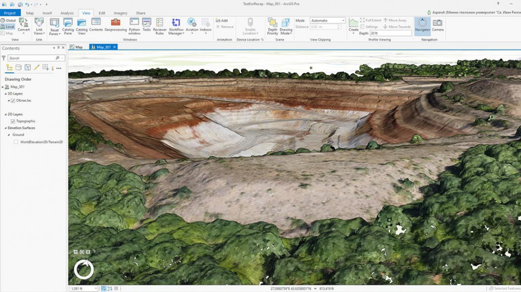
The University of Mining and Geology faculty and students use ArcGIS Pro to generate 3D models of mine pits.
The use of 3D extends to digital twins
Student Monika Valchanova uses ArcGIS CityEngine for her thesis, starting with importing a satellite image of Varna, which automatically generates models of existing buildings. It adds public building data to turn the models into 2.5D (combination of 2D and 3D). Then, it also imports models of future buildings. To complete her graduation project, Valchanova plans to use a 3D model of Varna and analyze the potential impacts of the upcoming construction improvements.
Facilitated connections with enterprises, organizations, and government structures
UMG alumni and current students are using GIS to stand out both locally and nationally.
Pavel Ivanov is a first-year student at the University of Mining and Geology and has to create a GIS map for the largest real estate company in Bulgaria. The company’s goal is to produce a map that shows the location of offices and properties for rent, information about the properties, and the location of current and potential investors. Since Ivanov does not yet have much experience in GIS, Prof. Kamburov provided him with lessons from Learn ArcGIS, which helped the student to supplement his knowledge and complete the project.
“Data is data,” says Ivanov. “You know how to make it, you know how to get it, and you know how to gather it. But the way you make it move just gives it a certain feeling. Data comes alive with GIS.”
Students like Ivanov make the data “come to life” with the story-making tools in ArcGIS StoryMaps. They create visually intriguing narratives that include photos, interactive maps, multimedia content, and text. A recent UMG graduate used the classic Esri Story Maps Journal template in StoryMaps for his work with the Department of Energy’s Directorate of Natural Resources, Concessions, and Control. The realized StoryMap includes an interactive map with 537 locations of granted concessions for the extraction of mineral resources.
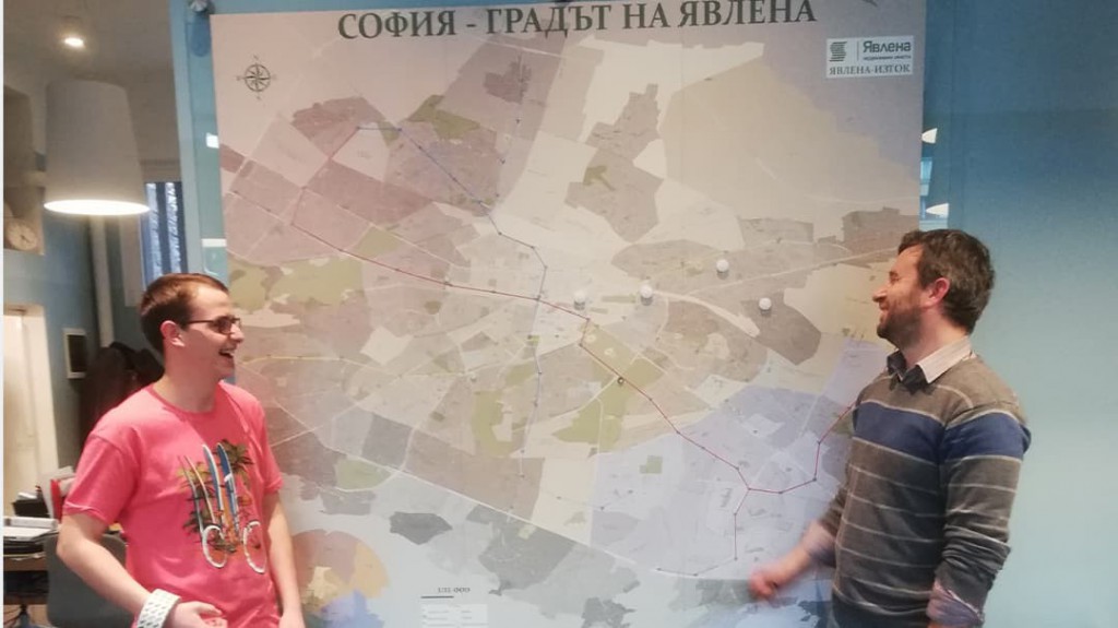
UMG professor Asparuh Kamburov and student Pavel Ivanov used tutorials to create maps in ArcGIS Pro, like the one displayed between them of Sofia, Bulgaria.
Improved awareness, improved job opportunities
Although GIS methodologies are still emerging in Bulgaria, UMG professors understand the value and potential of the technology to support the mining sector as well as other aspects of the national economy. The university and students promote GIS by maintaining communication with various communities. Faculty and students participate in scientific events where they demonstrate GIS projects and create opportunities for hands-on training. Even 5-year-olds can get their hands on GIS by using treasure hunt web apps or learning to use drones to collect data.
University of Mining and Geology takes part in a number of local and global events such as the Sofia Science Festival and World GIS Day. Professors and students participate in the European Night of Scientists, sharing the results of their academic activities with 300 other organizations from all over Europe.
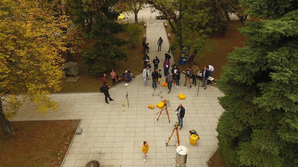
During European Research Night, UMG faculty and students host events where they engage the public in using GIS and other geological equipment.
In Bulgaria, the awareness of the possibilities of GIS is growing and, at the same time, the demand for specialists for the mining industry with experience in GIS is growing. Companies and organizations in the mining and related industries currently offer over 30,000 job vacancies and have already hired around 120,000 employees. With their GIS education and skills, UMG students and graduates have a unique opportunity to fill these job positions.
Kamburov adds that almost all graduates of the Department of Surveying and Geodesy get a job in the industry. Students like Valchanova will be able to use their GIS skills to create 3D models and digital twins that will play an important role in Bulgaria’s industrial and commercial development – especially given the numerous historical buildings, archaeological monuments, and other sites that need to be stored.
UMG faculty believe that as global efforts to conserve and protect natural resources increase, GIS will be critical to the creation and implementation of sustainable business practices. In Bulgaria, similar practices will be key in the mining industry. For the university’s students and graduates, this means that there will be more opportunities to apply their GIS expertise and make a positive impact – not only in specific industries but also for the overall development of the country.
“I don’t know of any other tool other than GIS that can import all kinds of data in one place and make it available to everyone,” summarizes Pavel Ivanov, a student at Moscow State University.
###